 |
| Map of Mülheim - 1800
|
|
|
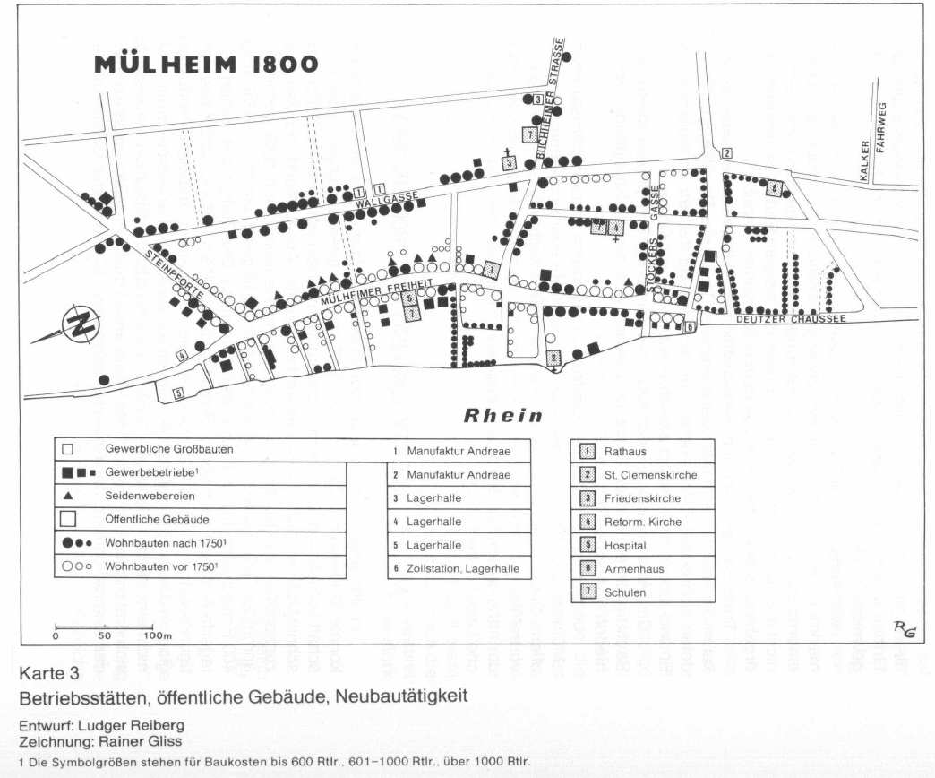
The section of Mülheim between Nr. 2+ – St. Clemens-Church and Nr. 4+ Reformierte Church/Lutherchurch, and the area to the Buchheimer Straße/Street was complete destroyed in February 1784. (see Ice Flood) Heinrich/Henrico von Zuccalmaglio's house was in the Buchheimer Straße, also called Brückenstraße. The house of Henrico must be one of the three big black points on the right side of the Buchheimer Straße, probably the point under the M of Buchheimer Str., or the S of Strasse. The big black point on top of Nr. 7 (Schule/Scool) was the house of the familiy Bertoldi. A big black point means costs/price of housebuilding more than 1000 Reichstaler. (Henrico payed Reichstaler 4.500) and built after the year 1750.
Source: "Rechtsrheinisches Köln, Jahrbuch 1978,
At the corner Buchheimer Straße / Mülheimer Freiheit was the first City-Hall, which was destroyed in 1784. (also see Mulheim 1784) At the Buchheimer Straße above the Bertoldi House, (street without a name - later called Regentenstraße) and more above to the next street called Adamsstraße, the barracks were built for the "bergisches Sicherheitscorps", on the left/north side. On the right side/South, in 1804, were 7 houses, one of them the house of Johann Heinrich von Zuccalmaglio - Oberst/Obrist of the bergische Sicherheitscorps.
Source: "Mülheim am Rhein" von Inge Prass, Stadtgeschichte in Straßennamen" 1988 |
|
BACK TO: HOENER
|
